Ambrose Channel
Fort Hancock, New Jersey


Updated in April 2011
Name: Ambrose Channel Lighthouse / Ambrose Tower
Nearest City: Fort Hancock, New Jersey
Location: Was 7.4 miles east of Sandy Hook's tip
Body of water: Atlantic Ocean
Style of lighthouse: Skeleton
Lens & Location:
Other Lens:
Lighthouse Website:
Groups to join: New Jersey Lighthouse Society
Owned by: United States Coast Guard
Managed by:
National Register of Historic Places: No
Do the grounds have lodging: No
Web Cams: No
On a license plate: No
On a USPS Stamp: No
Haunted: No
Photographed it: August 2, 2001
Purchase lighthouse prints from this page
Latitude: 40.45000 Longitude: -73.80000 approx.
For directions click Google Maps
Nearest City: Fort Hancock, New Jersey
Location: Was 7.4 miles east of Sandy Hook's tip
Body of water: Atlantic Ocean
Style of lighthouse: Skeleton
Lens & Location:
Other Lens:
Lighthouse Website:
Groups to join: New Jersey Lighthouse Society
Owned by: United States Coast Guard
Managed by:
National Register of Historic Places: No
Do the grounds have lodging: No
Web Cams: No
On a license plate: No
On a USPS Stamp: No
Haunted: No
Other Lighthouse Information:
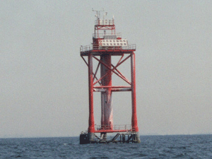
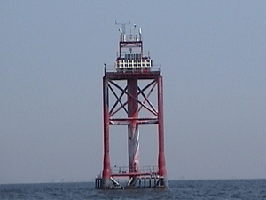
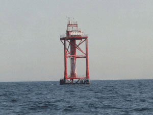
In 1967 the Lightship Ambrose was replaced with a Texas Tower. In October 1996 the tower was struck by the inbound 754 foot tanker Aegeo carrying 430,000 barrels of crude oil. In 1999 the tower was rebuilt into a red 3 legged tower located 1 ½ miles east of the old location. On January 22, 2001 it was hit by a 492-foot Greek-Maltese freighter Kouros V. For the last time on November 3, 2007 it was hit by a tanker. In September 2008 it was dismantled and replaced with flashing buoys. This was also NOAA's National Data Buoy Center automated weather station ALSN6.The Lighthouse Hunters Experience:
On a few days in August 2001 we sailed around the Sandy Hook Bay and the Atlantic Ocean photographing the local New Jersey lighthouses. This morning we pulled up anchor in Horseshoe Cove and sailed around the hook of Sandy Hook. Are maximum speed is 6 miles an hour so we passed some of the time by trolling for fish in the hot sun. This trip was before we had a digital camera and we used our 35 mm SLR. We were still inexperienced lighthouse hunters back then only seeing 450 lighthouses. We didn't take too many shots and now it's too late.Photographed it: August 2, 2001
Purchase lighthouse prints from this page
Latitude: 40.45000 Longitude: -73.80000 approx.
For directions click Google Maps

Photo taken on August 2, 2001

Photo taken on August 2, 2001

Photo taken on August 2, 2001
All photos contained in this site, © Copyright 1997-
by The Lighthouse Hunters - Christine & Tom Cardaci.
Images and text may not be used from this website without written permission. Contact Us for more information.
Images and text may not be used from this website without written permission. Contact Us for more information.


